Showing posts with label hikes. Show all posts

Tuesday, July 5, 2011

Trail Discovery for Kids

Highlighted Hike
River Trail
Washington, DC
 Hike Information
ü  The River trail is wide and flat. It is 1.4 miles out and back.
ü  The trail surface is a mix of gravel and mowed grass. It is stroller-friendly (bigger wheels will work best).
ü  The trail follows a peninsula of land with the Anacostia River on one side and the Kenilworth Marsh on the opposite.
ü  Link to the trail map.
 Age Appropriateness
ü  This hike is great for all ages but in particular toddlers and preschoolers. The trail is a fantastic introduction to hiking and nature.
 What is fun for kids?
ü  July is the best month to go because all the water lilies and lotus flowers are in bloom. It is beautiful!
ü  Having the kids choose which path they want to follow around the many ponds.
ü  Walking the boardwalk to the river.
ü  Riverside access to the Anacostia.
ü  Seeing wildlife – many types of butterflies and dragonflies, bull and green frogs, painted, red-eared and snapping turtles, deer, beaver and a lot of birds.
ü  Small visitor center to educate about marshes.
ü  Great place for nature photography.
ü  Picnic tables in the shade!
 Caution
ü  Hot, hot, hot in the summer! The River Trail is mostly shaded but not the boardwalk or ponds.
ü  Park is open from 7:00 am to 6:30 pm.

Friday, March 25, 2011

Trail Discovery for Kids

March 2011 Highlighted Hike
Graves Mill Trail
Madison County, Virginia
Hike Information
ü  2.5 miles out and back hike to the second water crossing or 4.2 miles out and back to the trail head at the Rapidan Fire Rd.
ü  Wide trail with easy, gradual elevation gain. There is one hill before the turnaround at the second water crossing. After the second water crossing, the trail gradually gains 200 feet.
ü  Continue straight on the Graves Mill Trail at .5 miles when it intersects the Staunton River Trail.
ü  The trail is not jogging stroller passable due to a stream crossing at .6 miles into the hike.
ü  Driving directions - From Culpeper, go south on U.S. 29 for about 20 miles. South of Madison, turn right at Route 230 West. Follow Route 230 for about four miles to Wolfton. Turn right at SR 662 and follow it to its end at the Shenandoah National Park boundary. Or access the trail from the Rapidan Fire Rd. at the end of Rt. 649 near Syria, Va.
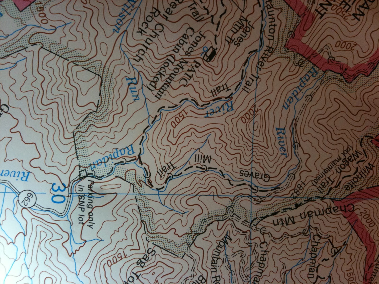
ü  Trail map - no online resource. Purchase PATC Map #10 or see photo.
Age Appropriateness
ü  This hike is best for children five years and older. 
What is fun for kids?
ü  The trail follows the babbling Rapidan River with a few rapids, particularly upstream.
ü  At .75 miles on the trail, there is a great rock beach for a picnic lunch, rock throwing or skipping, and stream play in warmer weather or testing one’s balance on the ice.
ü  At .4 miles on the trail, one of nature’s wonders is on view, beaver’s awe-inspiring engineering. The evidence of two beaver dams and two large lodges is littered on the river banks by the many pencil-pointed tree stumps. Possible opportunities to see the beavers in action are best during a dawn or dusk hike but shhh, beavers are very shy!
ü  At the Rapidan Fire Rd. trail head, there is a great swimming hole.
ü  Try a little catch and release and bring a fishing pole. There are many brown trout in the river.
Caution
ü  Two first stream crossings are difficult for children. The stepping stones are adult stride. Waterproof sandals or shoes are a good option.
ü  Popular hiking area. SNP provides twelve parking spots with parking restricted on the road.
ü  There are no bathroom facilities.
ü  Trash free park – pack your garbage out.